-
Your shopping cart is empty!
ORIENTEERING’S steps of development are adapted to the school’s goals according to Lgr11* and Gy11*, and the curriculum in physical education. It gives concrete examples of navigation skills that must be demonstrated at this level. The higher the level is, the higher the qualitative requirements will be.
Developed by Swedish Orienteering Federation (SOFT).
*The Swedish National Agency for Education

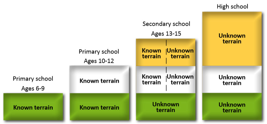
Suitable levels at for each age
The model below shows the type of area and the level of development suitable to use in the teaching of each year.
Developed by Swedish Orienteering Federation (SOFT).

Known terrain: means the school yard and areas in the school’s immediate vicinity.
Unknown terrain: means a nearby forest area of outdoor character close to the school.
Map understanding: Knowing that the map is reduction small scale and simplification version of reality.
Handrail: Distinct terrain objects that are easy to follow, for example, roads, paths, fences or large buildings. Less distinct handrails can be small paths, hedges, ditches and, vegetation boundaries.
Orientate the map: Alignment of the map consistent to the real north with the map image aligned with reality. This is achieved by the Red to Red principle.
Thumb your map: Positioning of the thumb on the map precisely where one is in reality. As one moves in reality, so too should the thumb consistent with that movement.
