-
Your shopping cart is empty!
MENU
- +
-
All products
+
- Blog +
- Deliveries +
- Payments +
- Contact us +
- SPECIAL OFFERS +
Your shopping cart is empty!
Google Earth has opened up a whole new world of amazing experiences of how the Earth’s different parts look like. Google Earth is a graphical 3D application whose purpose is to show the earth from above. It uses aerial photographs, satellite imagery and GIS information over the earth, and these join to form a mosaic of a virtual globe.
In the programme you can enter a location, zoom in down to city and street level. Everywhere on earth you can distinguish lakes, cities and rivers, and in most inhabited areas, you can see major traffic routes, parks, squares etc.
In the areas with higher resolution individual buildings, streets, bridges, cars and in some special cases even people can be identified.


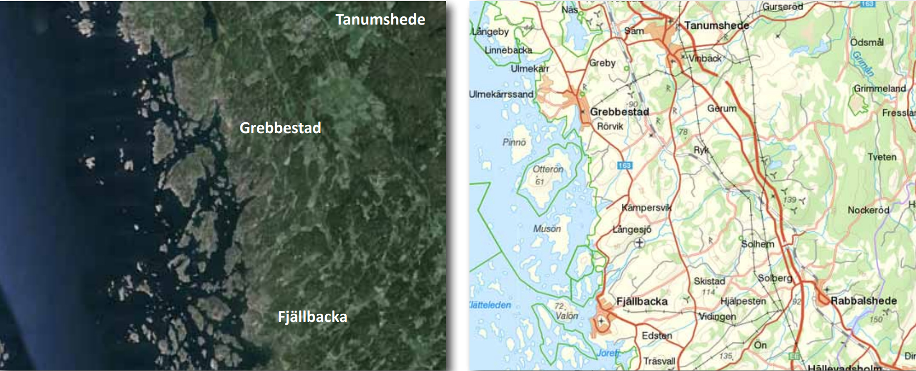
Using this software it’s much easier to understand how a traditional map is created. All maps are drawn in a unique way depending on their use - tourist maps, road maps, city maps are some maps we all use at some point. All these maps are a simplified representation of reality. The larger the area you want to map, such as the Nordic region as shown left, the less detail you can put on the map. The map becomes highly simplified in comparison with the map below.
The cities of Tanumshede, Grebbestad and Fjällbacka are not on the Nordic map but on this map you can add more detail because the area is much smaller. Houses and roads (yellow colour), forest (green colour), lakes (blue colour) as well as fields and meadows (white colour) appear very clearly. This map is suitable to use when you are orienteering by bicycle or car.