-
Your shopping cart is empty!
Downhill skiing at high speed!
In our daily life we face lots of different maps and we are informed constantly with different messages. At the ski slopes, both in Sweden and abroad, they try to inform skiers where to go and what challenges each slope contains. There are different colours (green, blue, red and black) that indicates the difficulty every downhill slope has. Green is the easy one, we call this slope for “the child slope”. The black colour is the slope with the highest difficulty.
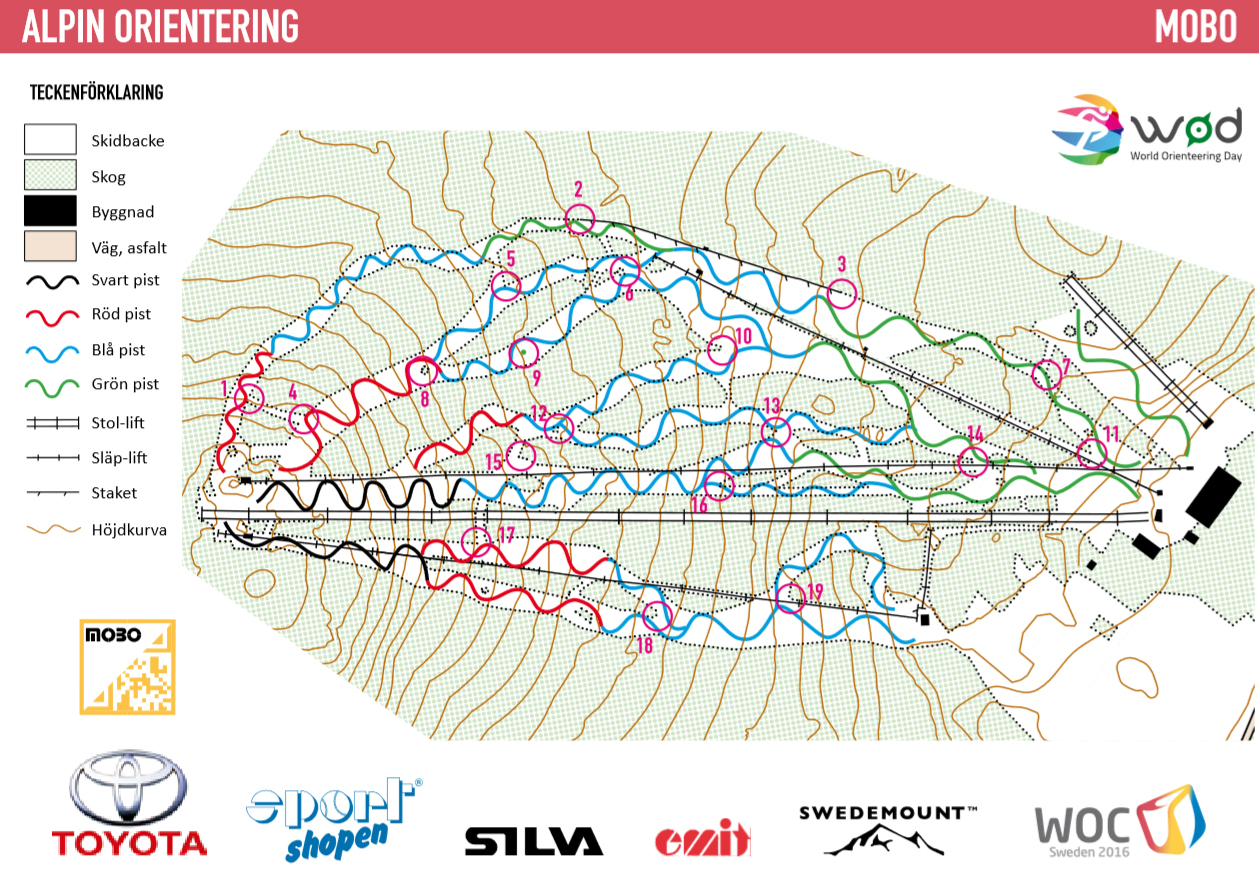
The map below is an attempt to show both the difficulties of the ski slopes and show the skiers how they can orientate during their stay in the ski slopes. Based on your skill ability you can choose the slopes that suit you, and afterwards you can challenge yourself and test another more difficult slope.

On the map, there are a number of checkpoints (none in the black slopes due these are too steep). These can be used to implement exercises that develop the knowledge of orienteering. E.g. you can decide for a certain period of time (45-60 minutes) whether you should visit as many checkpoints as possible. Another option is to find the checkpoints in numerical order.
Download the map in the phone!
The checkpoints can be marked in the same manner as in MOBO, i.e. a laminated orienteering control with control number and QR code. The checkpoints are placed on the edge of the slope or at another suitable place to avoid preventing other skiers. Via barcode scanner in the phone you scan the QR code to get a registration.
In connection with the school’s outdoor events in a ski slope you can add this kind of activity to be part of teaching ”to orientate”.
This activity of ”Alpine Orienteering” is quite new, but hopefully we can find similar activities in many ski slopes world wide in the future.
