-
Your shopping cart is empty!
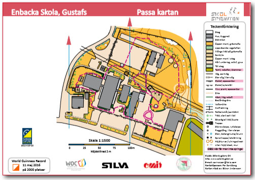
Orientate the map (Line-O, outdoor 1)
THE TEACHER FOLLOWS the dashed line and makes a stop at distinct objects/places. Students have a blank map and follow the teacher. The teacher reminds the students to ”thumb your map” and especially ”red-to-red”. The teacher asks the students ”Where are we?”, ”Where is for example the boulder on the map?”, ”In which direction do I point now.”
Students work together in pairs and show and answer the teacher’s questions by pointing on the map.

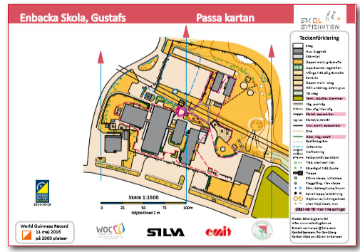
Orientate the map (Line-O, outdoor 2)
THE STUDENTS will be divided into three groups and should follow the dashed lines. There are control markers placed at different distinct points along each dashed line. The task is to highlight where these are situated. The teacher reminds students to ”thumb your map” and to focus on the ”red-to-red”.
Students can usefully cooperate two and two.

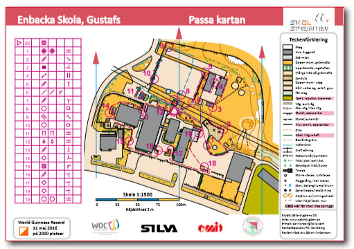
Master Map (Line-O, outdoor 2)
THE CHECKPOINTS MAY BE marked with orienteering markers and pin punches. If you have access to electronic punching systems such as EMIT or SPORTident these can be used advantageously. Checkpoints may also be marked in a simple way using plastic tape in bright colours.
AS A WARM UP, students can put out 1-2 controls and as warm down bring the same controls back again. However, this requires that you have a map for each control, but it may be worthwhile to produce these additional master maps.

